QUICK FACTS
Where is it? Exuma, Bahamas [23.46141962534, -75.900438330]
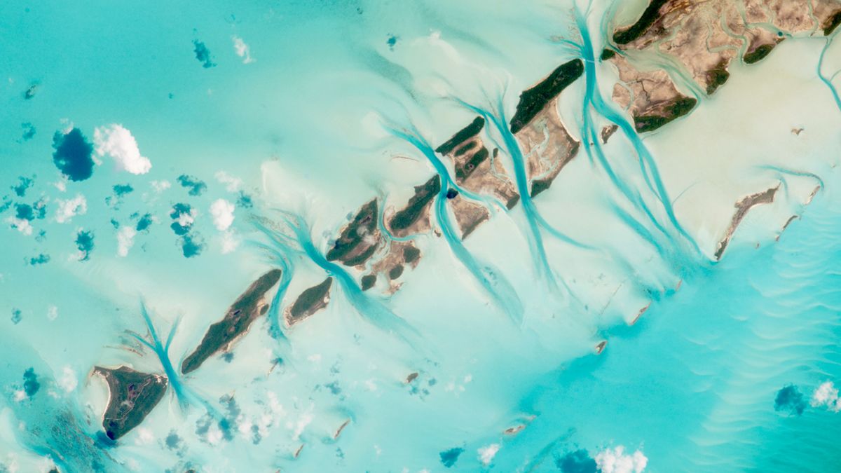
What’s in the photo? A string of islands, or cays, interspersed with deep tidal channels
Who took the photo? An unnamed astronaut on board the International Space Station (ISS)
When was it taken? July 15, 2015
This striking shot, captured by an unnamed astronaut aboard the ISS in 2015, shows deep tidal channels cutting through the seafloor between a series of small islands, or cays, once used by pirates in the Bahamas.
The line of cays stretches around 9 miles (14.5 kilometers) outward from southwest Great Exuma Island in the Exuma district of the Caribbean nation. From left to right, the named land masses are Bowe Cay, Hummingbird Cay, Culmer’s Cay, Tommy Young’s Cay, Davy Cay, Hog Cay, and Green Turtle Cay. (Some of the smallest cays are unnamed.) Part of the Great Exuma coast is also visible in the top right of the photo.
Exuma contains more than 360 individual islands and is located to the west of most of the other larger Bahamian islands. As a result, the Indigenous Lucayan people, who were enslaved and removed from the islands by Spanish explorers in the 16th century, referred to the region as Curateo, meaning “outer far distant land.”
Deep tidal channels can be seen between each landmass. These channels were created as water moved back and forth between the cays with the rise and fall of the tides, cutting through the seafloor like a hacksaw, according to NASA’s Earth Observatory. Each channel is hundreds of feet deep, while the surrounding lighter-blue sea is only 80 feet (24 meters) deep.
Related: See all the best images of Earth from space
The dark-blue lines are a distinctive feature when viewed from space. “For astronauts, this is one of the most recognizable points on the planet,” NASA representatives wrote.
In the past, Exuma’s cays were a hotspot for pirate activity because they were a great place to set up bases and hide treasure, according to the Earth Observatory.
Captain Kidd is thought to have favored the cays surrounding Great Exuma Island because the tidal channels were deep enough to harbor large ships at low tide. Some locals still believe that some of Kidd’s treasure is buried on one of Exuma’s cays.
These channels are home to a variety of marine life, including sea turtles, groupers, conchs, lobsters and seabirds. They also host key ecosystems, such as mangroves, seagrass meadows and coral reefs.
However, these habitats are being threatened by invasive red lionfish (Pterois volitans), which are wiping out smaller fish in the area and causing food chains to collapse, according to the Bahamas National Trust.


