

")


Support local journalism with a digital subscription for as low as $1 a month for the first 12 months.
A tropical system is gaining strength today (Sept. 24) in the Caribbean and is expected to move into the Gulf of Mexico by tonight or tomorrow. Lee County is under a Tropical Storm Watch. The forecast is calling for storm surge − prediction is 3 to 5 feet along the coast − and wind impacts, mostly Wednesday night and all day on Thursday.
This is a developing story and our reporters and photographers are on alert and ready to provide coverage, contributing the latest updates on flooding, cancellations and closures, and what you need to know.
Flood zones: See where yours is HERE.
More: With a Florida state of emergency, Fort Myers, Sanibel, Bonita warily watch growing storm
Lee County schools: Classes will be held Wednesday
Lee County public schools will be in session Wednesday, the school district announced Tuesday night.
“The School District of Lee County continues to closely monitor Tropical Storm Helene. Given the current trajectory of the storm, the School District has made the decision to end all after school activities by 4 p.m. on Wednesday, Sept. 25. However, all after school Activity Buses for tomorrow will be canceled.
This excludes After Care, which will remain open until 6pm, but all students must be picked up by that time.”
The district said it would issue an update on Wednesday about whether schools will be open Thursday.
FSW switches to online only as Helene pass off the coast
All Florida SouthWestern State College classes and operations will transition to remote learning and work on Thursday, Sept. 26, and Friday, Sept. 27. “Any further updates or changes to operations can be found at FSW’s official communication channels and www.FSW.edu,” the school said.
FGCU announces campus closure
FGCU is closing campus to all activities, including all events and classes, beginning at 9 p.m. Wednesday, Sept. 25. The university will remain closed through Thursday, Sept. 26. A decision about Friday operations will be announced by 3 p.m. Thursday. For more information, visit FGCU’s Emergency Management website for details.
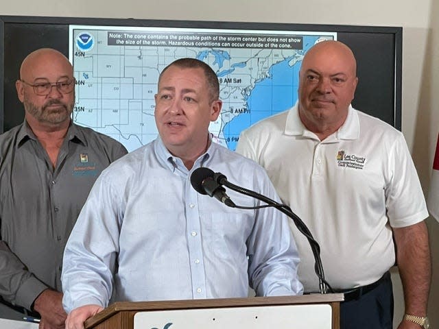
Lee County officials hold media briefing about Tropical Storm Helene
Lee County officials gathered today at the Old Lee County Courthouse to provide an update as they anticipate effects of Tropical Storm Helene in the coming days.
Benjamin Abes, director of Lee County Public Safety, said around noon Tuesday their emergency management team and public safety staff have been actively monitoring the tropics and working closely with state and our federal partners, including the National Weather Service and the National Hurricane Center.
As of the 11 a.m. forecast, Tropical Storm Helene had formed in the Caribbean, south of Cuba.
Abes said the conditions at the time indicate Helene carried sustained winds of 45 mph, expected to move northwest and into the Gulf of Mexico on Wednesday, intensifying as it moves north, “just off to our west.”
Read the full story by Tomas Rodriguez HERE.
DOH: Prepared to for special needs shelter operations in areas of landfall
The Florida Department of Health has prepared for special needs shelter operations to begin in areas of anticipated landfall.
In an emergency, such as an evacuation for a hurricane, you may need to go to a special needs shelter. If you know or care for an individual with a disability or a special need, such as a medical condition that requires assistance but not hospitalization, it is important that you pre-register with the Florida Special Needs Shelter Registry. You will need to log in with an existing account or create a new account.
Registering through the Florida Special Needs Registry allows local emergency management officials to provide important information and quickly assist you during an emergency. For more information, contact your county’s emergency management office or visit the Florida Special Needs Registry.
If you are eligible for a special needs shelter, your kit should include:
-
List of medications and dosage
-
A 30-day supply of medications
-
Vital medical equipment for those who may be electrically or oxygen dependent,
-
Backup energy sources for essential medical equipment
-
Any special dietary needs or food
-
Personal information including:
After completing the Florida Special Needs Registry, additional information will be provided to you by your local emergency management agency regarding evacuation and sheltering options available.
For more information on your local shelter status, please visit FloridaDisaster.org.
Evacuate? It’s wait and see on Sanibel Island
This just in from environment reporter Amy Williams:
In its most recent Tropical Storm Helene update, Sanibel mentioned the E word: Evacuation.
Not as anything mandatory – just as a precaution if storm impacts are too worrisome, the city said.
“Sanibel residents who feel that their homes may not be safe from the potential storm surge, winds, and rain from Tropical Storm Helene, should consider evacuating the island until the storm has passed the area,” the city wrote in a 2 p.m. press release, after noting the National Hurricane Center is predicting between 4 to 8 inches of rain, winds of 50 mph, and a potential 6-foot storm surge.
That’s not just potentially bad for Lee County’s barrier islands, but for nearby low-lying mainland communities, says Sanibel-Captiva Conservation Foundation research scientist Rick Bartleson.
“(With) about 6′ surge predicted for Fort Myers Beach with current consensus model track and strength,” wrote Bartleson in an email, “Harlem Heights could use fair warning.”
The once-upon-a-time farm community just over the causeway is still home to many working families and was hit hard by Hurricane Ian two years ago.
Should Sanibel be evacuated, hurricane re-entry permits are available at the Sanibel Police Department at City Hall for residents and businesses and for residents only at the the Sanibel Recreation Center.
Permits hours at the police department are weekdays from 8 a.m. to 4 p.m. and at the Sanibel Recreation Center from 7 a.m. to 7 p.m. Monday through Thursday, 7. a.m. to 5 p.m. and 8 a.m. to 5 p.m. Saturday.
Lee County declares local state of emergency; offices closed on Thursday
Lee County officials have declared a local state of emergency ahead of Tropical Storm Helene, expected to bring tropical storm force winds and a coastal surge of 3-5 feet starting Thursday morning. County offices will be closed Thursday, but normal operations are expected to resume on Friday. Officials encourage residents in flood-prone areas to review their evacuation plans and consider staying with friends or family inland.
Cape Coral mayor releases statement about Tropical Storm Helene
“As we monitor the storm in the Gulf, it’s crucial that every family in Cape Coral takes proactive steps to prepare while remaining calm. Now is the time to gather supplies, review your emergency plans, and stay informed through official channels. By staying prepared and working together, we can protect our community and be ready for whatever comes our way this hurricane season.” — Mayor John Gunter, City of Cape Coral.
Video from Cape Coral
Pine Island has made sandbags available
Sand and sandbags are available at Pine Island’s Fire Station No. 1 and the Pine Island Little League field parking lot, according to the Matlacha/Pine Island Fire Control District.
Sandbags are limited to 20 per resident. They’re available at Fire Station No. 1, 5700 Pine Island Road, at Pine Island Center.
Sand will be staged next door at the Pine Island Little League field parking lot. The sand is self-serve, so you’d need to fill your own bags.
“Limited shovels will be provided at the sand pile,” the fire control district said on Facebook. “We encourage you to bring your own

Lee County provides update on preparation for Tropical Storm Helene
Lee County Emergency Management is actively monitoring the tropics and working closely with state and federal partners, including the Florida Division of Emergency Management, the National Weather Service and the National Hurricane Center.
Public safety and county staff are working to prepare county facilities and operations.
The Emergency Operations Center is expected to be activated to a Level 2 on Wednesday morning.
As previously announced, the Lee Board of County Commissioners will conduct an emergency meeting at 2:30 p.m. today in the Commission Chambers to discuss a State of Local Emergency for Tropical Storm Helene and to receive an update on storm-related issues.
The public is invited to attend the meeting or watch on LeeTV or Lee County social media channels.
.County officials announced some operational updates at a noon press conference today. You can watch the press conference on the county’s YouTube channel at https://youtu.be/SwKj6L12lCc. The updates include:
Department of Transportation
Staff is:
-
Securing various facilities and ongoing projects that cannot be completed before Thursday;
-
Scheduling extra on-call personnel within Operations and Traffic divisions to work overnight on Wednesday and into Thursday;
Traffic
Operations
-
Inspecting drainage structures in lower-lying areas to make sure they are flowing freely;
-
Coordinating with Department of Natural Resources on weir gate operations to provide space for water to stage, where appropriate;
Natural Resources
-
Monitoring and evaluating hydrologic conditions from the network of sensors and gauges including groundwater levels, stream level and rainfall to assist in determining areas most vulnerable to flooding;
-
Working with South Florida Water Management District to clean creeks and streams of exotic and obstructing vegetation, recognizing in many cases they serve as the major watercourses for flood relief;
-
Documenting pre-storm conditions along our critically eroded beaches.
Solid WasteLee County Solid Waste urges residents to follow these important guidelines:
-
Refrain from cutting trees, doing major yard work, or placing large amounts of bulk waste at the curb.
Public Safety
Members of the community should take action to stay informed:
-
Monitor reputable local media outlets, the National Weather Service-Tampa, and the National Hurricane Center.
-
Follow Lee County Government and Lee County Public Safety on social media, including Facebook, YouTube, X and LinkedIn.
-
Sign up for AlertLee and download the LeePrepares app from Google Play or the App Store.
Have a plan and prepare for the effects of weather:
-
Review your Family Emergency Plan and an Emergency Supply Kit.
-
Prepare your home, secure loose items and ensure you have what you need on hand as you continue to monitor the tropics.
Know your home and your evacuation zone. Have a plan in place to evacuate, if need be, to a friend’s or family member’s house or a community outside the area.
To receive updates from Lee County Government, sign up for the newsletter here: www.leegov.com/resources/newsletters. Follow Lee County Government on Facebook, www.facebook.com/leecountyflbocc.
Photo gallery from Cape Coral
Closures, cancellations starting to be announced
Our staff is diving into social media groups and organizations to try to keep up with cancellations and closures. They are starting to happen, including these two on Facebook:In an abundance of caution, and to prepare for the potential Tropical Cyclone Nine, Bay Oaks (on Fort Myers Beach) will be CLOSED tomorrow, 9/25, and Thursday, 9/26. All programming, including Club Rec, will be canceled. We apologize for the inconvenience. Please stay tuned for updates – we hope to reopen on Friday, 9/27.
And this from the Mound House Facebook page:
Mound House Closed Wednesday and Thursday
Due to an abundance of caution and to allow staff enough time to prepare the site for the effects of the possible tropical cyclone, the Mound House museum and grounds will be closed Wednesday, September 25th and Thursday, September 26th. All tours, programs, and events are canceled for Wednesday and Thursday. Please call Mound House 239-765-0865 for more information.
Sandbags now available on Fort Myers Beach
From reporter Mickenzie Hannon: Sandbags are now available at Fort Myers Beach Town Hall, located at 2731 Oak Street. Residents can pick up bags at Town Hall and fill them at the end of Gulf Beach Road. Fort Myers Beach officials remind residents to bring their own shovels and be prepared to fill the bags themselves.
What is the tide forecast for SW FL as this storm develops?
More weather intel from environment reporter Chad Gillis, specifically water related:
High tides will be 8 am Wednesday and 9:30 am Thursday. Both single tide days.
Flood watches now being issued for SW FL
Reporter Laura Layden and others on our team are starting to get push notifications on our phone regarding flood watches: “Hurricane and Storm Surge Watches issued for West Central and Southwest Florida.”
Fort Myers Beach: Sand for bagging is low
According to our environment reporter Chad Gillis, Fort Myers Beach is running out of sand at the old town council building this morning. People are taking this storm serious, Gillis said. FMB could see 6 foot or more of surge Gillis has found out through his forecast research today.
Lee County storm prep: What to know
Lee County Emergency Operations: From our reporter, Kendall Little, here’s what to know when a storm is in the forecast.
Lee County holding a media briefing
Our reporter Mickenzie Hannon said Lee County is planning a briefing for the local media today at noon. We will have it covered.
Radar images of Tropical Storm Helene


Spaghetti models for Tropical Storm Helene
This article originally appeared on Fort Myers News-Press: Lee County live updates: What to expect, potential hurricane Helene


